
EducationFreeGeographySimulators

Google Earth VR

The XR School › Geography › Google Earth VR
Free Google Fly anywhere on Earth PC VR • SteamVR • Rift
Released 16 November 2016 • Steam • 94% positive from 3,200+ reviews • Cannes Lions 2017 Bronze

Google Earth VR

Stand on the summit of Everest, fly down the Grand Canyon and hover over your own school, all in one lesson. Google Earth VR turns the whole planet into a 3D model you can fly through, scale up and walk around. It is free, it is breathtaking, and for geography it remains one of the most powerful things you can show students in a headset.

Developer: Google
Price: Free on Steam
Platform: PC VR via SteamVR or Oculus PC
Subject: Geography • History • Landmarks
8.4
/10
XR School Score
Highly Recommended
Free • The whole planet in 3D • Cinematic tours • Street View • Needs a gaming PC • No standalone Quest version
94% positive • Steam 3,205 English reviews
Very positive
Overview

Google Earth VR is Google’s virtual reality version of Google Earth, released free on Steam on 16 November 2016. It uses the same 3D imagery as Google Earth to let you fly over cities, stand on mountain peaks and soar out into space until the whole planet hangs in front of you. You steer by pointing a controller in the direction you want to go, grab the world to drag it around you and change your own size so you can look down on a continent or stand among the buildings of a city street.

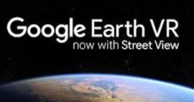
Alongside free exploration there are cinematic tours and hand‑picked destinations, including the Amazon River, Manhattan, the Grand Canyon and the Swiss Alps. You can search for any place, and a 2017 update added Street View imagery so you can drop down from the 3D model to real panoramic photographs taken at ground level. The game won Best HTC Vive Experience at the 2016 Vivey awards and a Bronze Innovation Lion at Cannes in 2017.

Geography at a Scale You Can Feel On a map, the Grand Canyon is a brown line. In Google Earth VR it is a mile deep chasm you can fly into. Seeing the true scale of landforms, how rivers carve valleys, how cities sprawl and how close coastal towns sit to the sea gives students a sense of place that is very hard to build from photos and atlases alone. Many teachers start with a simple request: find our school, then fly to a place we are studying.
Lesson Ideas
🏔️
Landforms
Fly along a river from source to mouth, or compare glaciated valleys with river valleys.
🌊
Coasts and hazards
Visit eroding coastlines, volcanoes and fault lines to see how landscapes change.
🏙️
Urban geography
Compare the layout of a megacity with your own town, from the CBD to the suburbs.
🏛️
History and RE
Stand at the Colosseum, the pyramids of Giza or Jerusalem’s Old City to set the scene for a topic.
How to Run It on a Meta Quest There is no standalone Quest version of Google Earth VR. It runs on a Windows PC with a SteamVR or Oculus PC headset, and Quest owners can play it by connecting to a gaming PC with Quest Link, Air Link or Steam Link. It also needs a broadband connection, because the imagery streams from Google’s servers. If your school only has standalone Quest headsets, try our review of Wooorld, which brings Google’s 3D map data to the Quest without a PC.
Google Earth VR vs Wooorld
Feature
Google Earth VR
Wooorld
Price
Free
$9.99 plus optional extras
Hardware
Gaming PC and PC VR headset
Standalone Meta Quest
Map style
Fly through the full planet
Tabletop 3D map in your room
Extras
Cinematic tours, Street View
Map sits in your real room (mixed reality)
Best for
Awe and scale
Easy setup in class
Curriculum Value
Sense of place and scale
9.6
Geography curriculum fit
8.8
Value for money
10
Ease of use
8.0
Hardware accessibility
4.0
Strengths and Limitations
Strengths
  • Completely free
  • The whole planet in 3D, searchable
  • Real sense of height, depth and scale
  • Cinematic tours of famous places
  • Street View panoramas at ground level
  • Very positive reviews from thousands of players
  • Award winning design
Considerations
  • Needs a gaming PC (GTX 970 or better)
  • No standalone Quest version
  • Needs a good internet connection
  • No built‑in lesson tools or quizzes
  • 3D detail varies between places
  • Fast flying can cause motion sickness
  • English only
For Teachers: Plan the Route, Then Let Them Fly Google Earth VR suits the KS3 and GCSE Geography topics on rivers, coasts, glaciation, tectonic hazards and urban change, and works well as a hook in history and RE. Give students a short route to follow and questions to answer at each stop, and use the comfort settings, which limit the field of view while moving, for anyone who feels unwell. Because it needs a PC, most schools run it as a single station with the headset view mirrored on the board so the whole class can follow along.
Free
Steam • SteamVR or Oculus PC • Quest via Link or Air Link
Get on Steam → More geography apps →
Quick Facts
Developer
Google
Released
16 November 2016
Price
Free (Steam)
Platform
PC VR via SteamVR or Oculus PC • VR only
Steam reviews
Very positive: 94% of 3,205 (English)
Minimum PC
Intel i5‑6400 • 8 GB RAM • GTX 970 or R9 Fury
Storage
4 GB (8 GB recommended)
Internet
Broadband required
Language
English
Awards
Vivey 2016 • Cannes Lions 2017 Bronze • Lumiere 2017
Verdict
Google Earth VR is still one of the most impressive free experiences in virtual reality, and one of the most useful for geography. Flying through real landscapes at true scale gives students a feel for rivers, mountains, coasts and cities that no map can match, and the cinematic tours and Street View add even more. Its weaknesses are practical: it needs a gaming PC and an internet connection, and there is no standalone Quest version. If you have the hardware, it belongs in every geography department.

Gareth Griffiths

Gareth Griffiths is a scientist and the founder of World of Teaching, a free library of over 1,000 teacher made PowerPoints. He set up The XR School to help teachers, schools and parents find virtual and augmented reality apps that genuinely help young people learn, and to give an honest view of what each app teaches, which headsets it needs and what it costs.