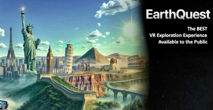
Geography

Earth Quest

Home Humanities Geography Earth Quest (WorldLens)
🌍
🛰️
🌍 VR Earth Explorer · Meta Quest · Google Earth 3D · Street View · AI Guide · Multiplayer
✨ Now WorldLens · Google Earth data · 8K Street View · Time Travel · World AI · 34+ languages

Earth Quest

Now rebranded as WorldLens on the Meta Store

The most powerful open-world geography tool available on standalone VR — powered by Google Earth 3D data and the full Google Street View library. Fly over any city on Earth in immersive 3D, descend to street level in 8K uncompressed quality, travel back in time to see how places looked years ago, and bring along an AI travel companion that speaks your language and answers questions about wherever you are. The Geography classroom equivalent of having Google Earth VR — now accessible on a standalone Quest headset.

~$11.99 Meta Quest 2/3/3S/Pro ✓ Entire Earth in 3D ✓ 8K Street View ✓ Time Travel ✓ AI travel guide ✓ All ages
Meta Store (WorldLens) earthquest.site
📌 Now Listed as "WorldLens" on the Meta Store

The app known as "EarthQuest" or "Earth Quest" on older reviews has been rebranded as WorldLens: All-in-One Virtual Travel on the Meta Store — it is the same app, continuously updated by the same developer (Boec). The underlying technology, Google Earth 3D data and Street View integration, remains the same. If you search for it on the Meta Store, use "WorldLens" or follow the link below. The developer's website is earthquest.site. This review covers the current WorldLens version which includes significant additions since the original launch: World AI, 3D Street View, Time Travel and Upscale 3D Imagery.

XR Rating
4.3
⭐⭐⭐⭐
Platform: Meta Quest 2/3/3S/Pro  ·  Price: ~$11.99 base · World AI add-on extra  ·  Developer: Boec (WorldLens)  ·  Data: Google Earth 3D + Street View · 34+ languages
About the App

What is Earth Quest / WorldLens?

Earth Quest — now officially called WorldLens on the Meta Store — is a VR Earth exploration application that brings the power of Google Earth 3D and Google Street View into a standalone Meta Quest headset. It is the closest available standalone equivalent to Google Earth VR, the celebrated PC VR application that first made it possible to fly over the planet in immersive 3D — but unavailable on Quest. WorldLens fills that gap with additional features that the original PC version never had: AI conversation, multiplayer, time travel and 8K street-level imagery.

The app uses Google's global 3D map data — the same underlying satellite and photogrammetric surveys that power Google Maps and Google Earth — to construct a three-dimensional representation of the entire planet. Nearly every recognisable city on Earth is available in immersive 3D, meaning students can fly over London, descend into the streets of Tokyo, orbit the Great Wall of China, or visit the neighbourhood of a student whose family originates from Lagos or Mumbai. The coverage is global, constantly updated, and includes residential streets in most countries.

Heise Online comparison review: Among the three Google Earth VR apps available on Meta Quest (Fly, EarthQuest/WorldLens, and Wooorld), WorldLens offers "the best Street View integration" of the three. The review noted its superior graphics customisation and settings depth, making it the choice for users who want maximum control over visual quality and rendering fidelity.

The app has been continuously developed since its launch in 2023, with each major update adding substantial new functionality. The current version — listed as WorldLens — includes: AI-powered Upscale 3D Imagery for enhanced close-up quality, 3D Street View (a first for VR Earth apps), Time Travel to compare historical imagery, an AI travel companion (World AI) that communicates in your language, multiplayer co-exploration, a realistic day/night cycle and adaptive atmospheric haze. It supports 34+ languages including all major European languages plus Arabic, Japanese, Korean, Thai and Vietnamese.

Features

What's Inside

🌍
Google Earth 3D — The Entire Planet in VR
Nearly every recognisable city on Earth is available in immersive 3D, including residential areas — meaning a student's own home street is likely included. Fly from space down to any location, zoom in from a global view to a street corner in seconds. The AI-powered Upscale 3D Imagery feature enhances visual quality at close range, pushing the rendering beyond what the raw Google data would normally show at standalone headset resolutions. Dynamic terrain rendering provides unlimited render distance and fine detail simultaneously without compromising performance. For Geography classrooms, this means any location on the GCSE or A-level specification — Mumbai's slums and skyscrapers, the Sahel drought zone, the Maldives atolls, London's docklands regeneration — can be visited and explored from any angle in a single lesson.
📸
8K Street View — Uncompressed, 3D, All Google & Community Imagery
WorldLens delivers the highest fidelity Street View experience available on any standalone VR headset — raw 8K quality at maximum screen resolution, covering all Google Street View imagery plus Community Street View contributions from around the world. A spherical preview appears on your hand as you navigate, allowing you to preview locations before dropping in. WorldLens was the first VR Earth app to introduce genuinely 3D Street View — rather than placing you in a flat 360° sphere, the environment has depth and spatial structure at street level. For Geography fieldwork, this means students can walk through a Mumbai street market, stand on a narrow street in Marrakech's medina, or examine the architecture of a Cape Town suburb — all at a level of visual fidelity sufficient for meaningful observation and description.
Time Travel — See How Places Changed Over the Years
The Time Travel feature allows you to step back through the historical record of Google Street View imagery at any location — comparing how a place looked in different years, tracking urban development, landscape change, coastal erosion, post-disaster rebuilding or infrastructure growth. For Geography, this is one of the most curriculum-relevant features in any VR Earth app: stand on a street in Shanghai and slide through its transformation over the past decade; observe the expansion of a city into surrounding farmland; examine how a coastline has changed due to erosion or managed retreat. This directly supports GCSE and A-level topics on urban change, development, natural hazard recovery and environmental change.
🤖
World AI — AI Travel Companion & Tour Guide (Premium Add-on)
World AI is an AI-powered companion integrated directly into the VR environment. It communicates in your own language, visualises and understands your virtual surroundings to provide contextually accurate responses, accesses real-time information, acts as a travel guide for wherever you are in the world, and can automate guided tours — flying you between points of interest with narrated explanations. For a Geography or History teacher, this means students can ask questions about a location directly while exploring it in VR and receive contextual, intelligent answers. This is available as a premium add-on over the base price.
👥
Multiplayer & Comfort — Explore Together, All Ages
Multiplayer allows multiple Quest users to explore the same location simultaneously via private rooms and room codes — no more passing the headset around. A teacher and several students can fly over a city together, meet at a street corner and discuss what they observe. Motion comfort settings include snap turning and a movement vignette to minimise motion sickness — important for students new to VR or sensitive to motion. The day/night cycle and atmospheric haze are adjustable in real time, allowing the same location to be experienced under different lighting conditions. Suitable for all ages with no content concerns.
School Value

Curriculum & Educational Fit

Geography — global fieldwork
97%
Human geography / urban
95%
Change over time (Time Travel)
90%
Age appropriateness
99%
EAL / cultural identity
88%
Ease of use (UI complexity)
55%

WorldLens (Earth Quest) is the most powerful Geography tool available on standalone VR — its scope is literally the entire planet. Any location studied in any Geography curriculum can be visited, flown over and explored at street level. For GCSE and A-level Geography, this means every case study location — Mumbai, the Maldives, the Sahel, Snowdonia, the Mississippi Delta, the Three Gorges Dam — can be experienced rather than merely described from a textbook photograph. The combination of 3D aerial view, Street View, and Time Travel covers the three most common Geography fieldwork needs: spatial context, street-level observation, and change over time.

For Human Geography, the ability to compare urban morphology across cities — the grid layout of Chicago vs the organic street pattern of Cairo vs the planned density of Singapore — is immediately curriculum-applicable. For Development Studies, juxtaposing the urban landscape of a high-income country city with a low-income country city at street level makes abstract development indicators concrete and memorable. For Environmental Change, the Time Travel feature showing coastal erosion, urban sprawl, deforestation or post-disaster recovery over years is a uniquely powerful teaching tool. For EAL students and Cultural Identity, being able to fly a student to their family's home city or neighbourhood in VR — and sharing that experience with their classmates — is one of the most meaningful inclusion activities available in any VR app. Suitable for all ages; no content concerns.

Best use in school: GCSE/A-level Geography case study visits (any location globally) · Human geography urban comparison · Time Travel for environmental/urban change over time · Virtual fieldwork for locations the school could never visit · EAL cultural identity sessions · Geography lesson starter — fly to today's specification location.
XR School Verdict
Geographic scope10/10
Street View quality9/10
Time Travel feature9/10
World AI guide8/10
Ease of use / UI5/10
Offline capability4/10
Bottom line: The most geographically powerful VR tool available on standalone Quest — the entire planet in 3D, 8K Street View of anywhere, Time Travel through historical imagery, AI guide and multiplayer. Scope is unmatched: any GCSE or A-level case study location can be visited in a lesson. The UI is more complex than competing apps and requires good Wi-Fi, but for Geography teachers it is indispensable. The World AI add-on elevates it further for guided exploration.
Pros & Cons
✓ Entire Earth in 3D — no other app matches this
✓ 8K Street View — best on any standalone Quest
✓ Time Travel — historical Street View comparison
✓ World AI — guided tours in your language
✓ Multiplayer — explore together
✓ 34+ languages including Arabic, Japanese
✓ Upscale 3D Imagery — AI visual enhancement
✓ Day/night cycle · adaptive haze
✓ Motion comfort settings
✓ All ages · zero content concerns
✗ UI more complex than Fly or Wooorld
✗ Requires good Wi-Fi — not offline-capable
✗ World AI costs extra beyond base price
✗ Data quality varies by location
✗ Not as intuitive as original Google Earth VR (PC)
Quick Info
PlatformMeta Quest 2/3/3S/Pro
Price~$11.99 + AI add-on
Store nameWorldLens (was EarthQuest)
DeveloperBoec (earthquest.site)
Map dataGoogle Earth 3D + Street View
Street View8K · 3D · all Google imagery
Time Travel✓ Historical Street View
World AI✓ Premium add-on
Multiplayer✓ Private rooms
Languages34+ including Arabic, Japanese
OfflineRequires Wi-Fi
Best forGeography · Global fieldwork
🌍 Google Earth VR on Quest
WorldLens / EarthQuest (this) — Best Street View, Time Travel, World AI, most settings control. Best for Geography power users.
Fly — Simplest, most beginner-friendly. Best for first VR experience with Earth exploration.
Wooorld — Most social/multiplayer features, GeoGuessr-style games, AI. Feature-rich but can feel overwhelming.
🌍
Get on Meta Store (WorldLens)
Earth Quest · ~$11.99 · AI add-on extra
© The XR School · VR & AR Apps for Education